Each year hundreds of thousands of trekkers from all around the world go to Nepal to experience the majestic Himalayas and get a sneak peek of the Himalayan lifestyle. However, if you are new to trekking in Nepal, and especially wondering about the Best Treks in Nepal, then this comprehensive blog post will help get you an idea on which trekking trail will suit you the best.
| wdt_ID | Trek Route | Max Altitude | Trek Length | Difficulty | Best Months |
|---|---|---|---|---|---|
| 1 | Poon Hill Trek | 3,210 | 7 Days | Easy | All Year Round |
| 2 | Annapurna Base Camp Trek | 4,130 | 10 Days | Moderate | Mar, Apr, May, Sep, Oct, Nov |
| 3 | Poon Hill + Annapurna Base Camp Trek | 4,130 | 13 Days | Moderate | Mar, Apr, May, Sep, Oct, Nov |
| 4 | Annapurna Circuit Trek | 5,416 | 18 Days | Moderate – Hard | Mar, Apr, May, Sep, Oct, Nov |
| 5 | Langtang Valley Trek | 4,773 | 10 Days | Moderate | Mar, Apr, May, Sep, Oct, Nov |
| 6 | Mardi Himal Trek | 4,500 | 10 Days | Moderate | Mar, Apr, May, Sep, Oct, Nov |
| 7 | Everest Base Camp Trek | 5,346 | 15 Days | Hard | Mar, Apr, May, Sep, Oct, Nov |
| 8 | Everest Base Camp + Gokyo Valley Trek | 5,357 | 19 Days | Hard | Mar, Apr, May, Sep, Oct, Nov |
The following are the best treks in Nepal compiled by our team at Nepal101
Ghorepani Poon Hill Trek
Quick Overview of Ghorepani Poon Hill Trek
Difficulty:Easy – Moderate
Best Months to Trek: All Year Round
Max Altitude: 3,210 meters
Program Duration: 7 Days 6 Nights
Annual Visitors: 100,000+
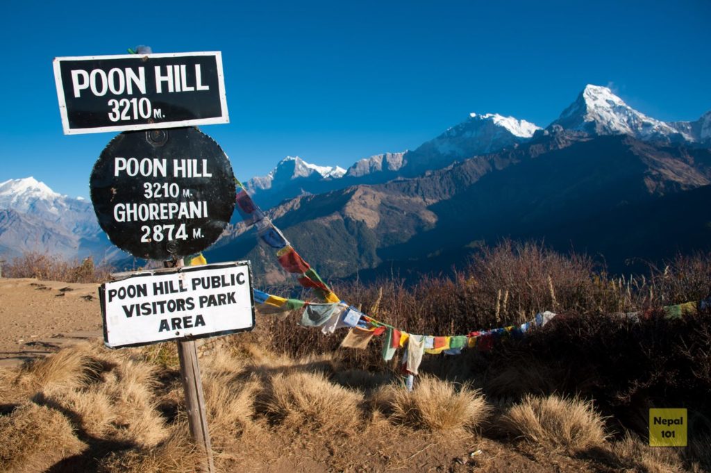
Known to almost everyone as the Beginners Trek – the Ghorepani Poon Hill Trek is the most trekked route in the Nepal and takes place in the Annapurna Region. If you are short in time – but want to experience trekking in Nepal, enjoy the panoramic view of the Annapurna Range, and visit traditional Gurung style villages, then the Ghorepani Poon Hill Trek is for you.
Usually the journey to the trekking point starts from Pokhara – the major tourist hub for treks in the Annapurna Region. Then the trail heads towards Naya Pool, the actual trekking starting point – around 2 hours of drive from Pokhara. The Poon Hill Trek is usually a circular route that starts from Nayapul reaching Ghorepani through Hille. After reaching Ghorepani, the hike to Poon Hill usually starts early in the morning next day.
The best moment of the the Ghorepani Poon Hill Trek is right at dawn at the view tower on top of Poon Hill (3,210 meters). When the first rays of the sun hits the mountain and the Himalayas appear reddish golden – a truly majestic moment worth every grueling steps taken half-awake. The rest of the trek has you walking along the ridges of the hills being followed by the scenic mountain ranges while exploring lush greenery and blossoming of the Bright-Red Rhododendron flowers.
Make sure to explore around the village of Ghandruk. It is one of the most famous Gurung villages in Nepal known for producing the brave Gurkha soldiers. The older Ghandruk area is full of traditional Nepali architecture and designs.
Ghorepani Poon Hill Trek Distance Coverage
Altitude and AMS at Ghorepani Poon Hill Trek
Since the highest altitude is 3,210 meters, the chances of getting altitude sickness on the Poon Hill Trek is pretty low. However, drinking lots of water, eating warm food and ascending gradually is still the best way to prevent any form of AMS.
Insider Tips for Ghorepani Poon Hill Trek
Following are a few insider tips that our team at Nepal101 recommends for the Ghorepani Poon Hill Trek –
- Start clockwise. We recommended to start from Nayapul and trek from the Hille Side instead of starting from Ghandruk. It is easier on the knees to conquer the 3000+ steps of Ulleri while going up. Starting the trek from Ghandruk side makes it difficult on the knees while descending on the stone steps.
- Poon Hill Trek is also known as the sunrise trek – so there will be a lot of people to watch the sunrise. If the sky is clear when you reach Ghorepani in the evening, the sunset is equally beautiful as the sunset. So why not make it to both?
Poon Hill Trek is short, relatively easier and meant for beginner trekkers
Poon Hill Trek Route Map
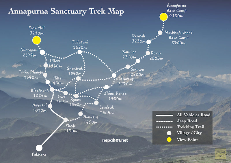
The Poon Hill trek route starts from Pokhara heading through Nayapul to Tikhedhunga then Ulleri reaching Ghorepani. After the morning hike to Poon Hill, the trek continues clockwise towards Tadapani and Ghandruk ending at around Siwai or Kyumi area before heading back to Pokhara.
Annapurna Base Camp Trek
Quick Overview of Annapurna Base Camp Trek
Difficulty: Moderate
Best Months to Trek: March, April, May, September, October, November
Max Altitude: 4,130 meters
Program Duration: 12 Days 11 Nights
Annual Visitors: 50,000+
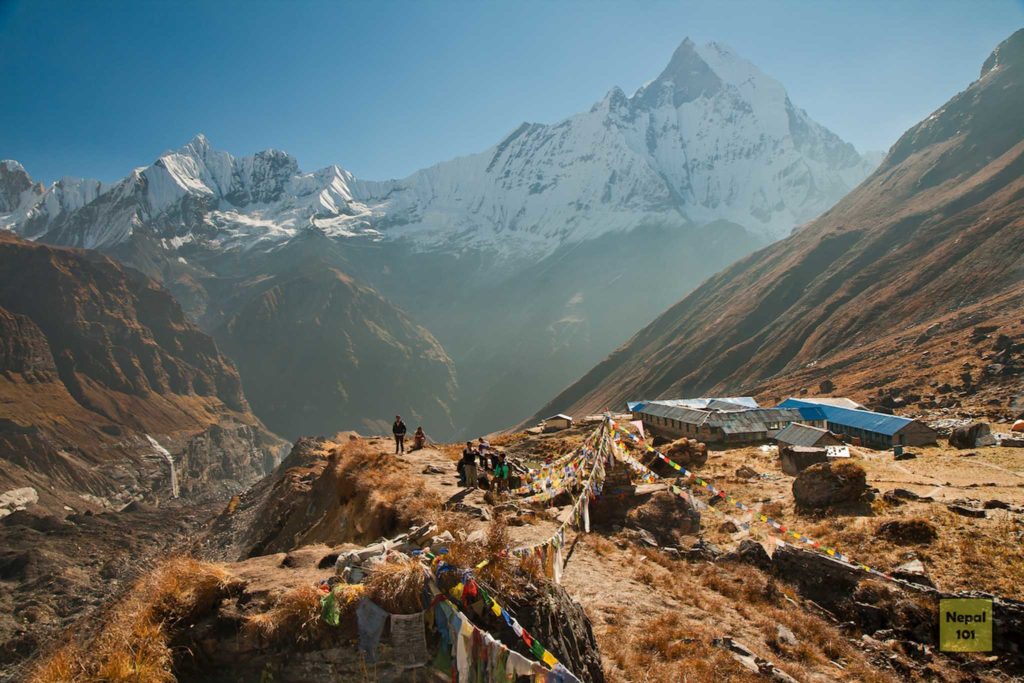
The Annapurna Base Camp Trek is also one of the most trekked route in the Nepal and takes place in the Annapurna Region as well.
The Annapurna Base Camp lies at a height of 4,130 meters and is where mountaineers start their summit of Annapurna I, the 10th highest peak in the world at 8,091 meters. The trail goes alongside terraced rice paddies, lush rhododendron forests and high altitude landscapes with the Annapurna Range in view most of the times. Moreover, it also passes through villages of ethnic Gurung and Thakali communities. If combined with the Ghorepani Poon Hill trek, then it is also called the Annapurna Sanctuary Trek.
The trek overall is beautiful and gives you a very up close experience with Annapurna and Machhapuchhre mountains. It is especially beautiful during spring as rhododendron flowers along the trail turn red, pink and white. Moreover, travelers can take a dip in the warm natural spring at Jhinu Dada at the end of the trek.
Physically fit? Willing to take up the challenge to witness some jaw dropping views? Then Annapurna Base Camp trek is the trek for you.
Annapurna Base Camp Trek Distance Coverage
Altitude and AMS at the Annapurna Base Camp Trek
Most of our trekking clients start experiencing mild headache after Machhapuchre Base Camp (MBC) even under normal acclimatization schedule. We recommend following a similar altitude gain as in our program and not rushing to higher altitudes to shorten the program. Make sure to drink lots of water and eat freshly cooked food at the tea houses. Combine proper nutrition with enough rest to prevent and recover from symptoms of altitude sickness. Eating Garlic Soup is a natural remedy in the villages to prevent altitude sickness.
Insider Tips for Annapurna Base Camp Trek
Following are a few insider tips that our team at Nepal101 recommends for the Annapurna Base Camp Trek –
- The number of Tea Houses are limited in Annapurna Base Camp (4130 meters) itself. The tea house owners give preference to bigger travel groups coming through agency because of the regular business relationship. If you are an independent travelers, an alternative is to stay at Machhapuchre Base Camp (MBC). From MBC you can leave early for ABC in the following day to catch the sunrise.
- The morning views of Annapurna South / Machhapuchre mountains from Chomrong and from Deurali enroute to MBC is breathtaking. Make sure to take good photos in these areas.
- It almost always rains/snows in the afternoon time in this part of the trek. Make sure you pack light raincoats.
If you are looking for something with a longer duration than Poon Hill Trek and close up view of the Annapurna Range of mountains – then the Annapurna Base Camp Trek is for you.
Annapurna Base Camp Trek Map

The Annapurna Base Camp Trek trail starts from around Siwai or Kyumi area after a jeep ride from Pokhara. The train continues towards Jhinu Danda towards Chomrong then covering Sinuwa, Bamboo, Dovan, Deurali, Machhapuchhre Base Camp (MBC) before finally arriving to Annapurna Base Camp (ABC).
Poon Hill + Annapurna Base Camp Trek
Quick Overview of Poon Hill + Annapurna Base Camp Trek
Difficulty: Moderate
Best Months to Trek: March, April, May, September, October, November
Max Altitude: 4,130 meters
Program Duration: 13 Days 12 Nights
Annual Visitors: 50,000+
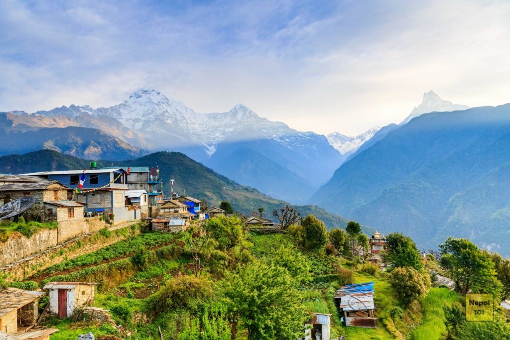
Poon Hill + Annapurna Base Camp trek, is also known as the Annapurna Sanctuary Trek. This trek offers a complete package of mountain adventure for travelers wanting to conquer the Annapurna Region. The trek goes through the Ghorepani Poon Hill route and then reaches Annapurna Base Camp (ABC) Trek, passing through Machhapuchhre Base Camp (MBC) surrounded by local villages with local culture.
The trek overall is authentic, exotic, beautiful and gives you a very up close experience with Annapurna and Machhapuchhre mountain ranges. It is especially beautiful during spring as rhododendron flowers along the trail turn red, pink and white. Moreover, travelers get a unique opportunity to take a dip in the warm natural spring at Jhinu Dada and get refreshed at the end of the trek. No wonder, it is one of the best treks in Nepal.
Poon Hill + Annapurna Base Camp Trek Distance Coverage
Altitude and AMS at the Poon Hill + Annapurna Base Camp Trek
The Poon Hill part of the treks is less than 2,500 meters, thus there is no major risk associated to Altitude Sickness. Taking the Poon Hill route first and then heading to the Annapurna Base Camp area is a smart acclimation decision. This is because the body gets used to the strenuous uphill and downhill ranging from 2,500 meters to 3,210 meters.
Most of our trekking clients start experiencing mild headache after Machhapuchre Base Camp (MBC) even under normal acclimatization schedule. We recommend following a similar altitude gain as in our program and not rushing to higher altitudes to shorten the program. Make sure to drink lots of water and eat freshly cooked food at the tea houses. Combine proper nutrition with enough rest to prevent and recover from symptoms of altitude sickness. Eating Garlic Soup is a natural remedy in the villages to prevent altitude sickness.
Insider Tips for Poon Hill + Annapurna Base Camp Trek
Following are a few insider tips that our team at Nepal101 recommends for the Poon Hill + Annapurna Base Camp Trek –
- Poon Hill provides a panoramic view which is a fantastic opportunity to take landscape photos. Whereas Annapurna Base Camp area is more up close and right in the base of the mountain.
- The morning views of Annapurna South / Machhapuchre mountains from Poon Hill, Tadapani, Chomrong and from Deurali enroute to MBC is breathtaking. Make sure to take good photos in these areas.
- It almost always rains/snows in the afternoon time in this part of the trek. Make sure you pack light raincoats.
The Poon Hill + Annapurna Base Camp Trek is the best combination to experience the Annapurna area at one go since the trails are connected after Ghandruk towards Chomrong.
Poon Hill + Annapurna Base Camp Trek

The Poon Hill + Annapurna Base Camp Trek trail starts from Nayapul or Birethanti area after a jeep ride from Pokhara. The first phase of the trek goes clockwise from Nayapul to Birethanti towards Tikhe Dhunga. The steep inclination of Ulleri ends after reaching Ghorepani. The train continues from Ghorepani towards Tadapani, Chomrong then covering Sinuwa, Bamboo, Dovan, Deurali, Machhapuchhre Base Camp (MBC) before finally arriving to Annapurna Base Camp (ABC).
Annapurna Circuit Trek
Quick Overview of Annapurna Circuit Trek
Difficulty: Moderate – Hard
Max Altitude: 5,416 meters
Best Months to Trek: March, April, May, September, October, November
Program Duration: 18 Days
Annual Visitors: 50,000+
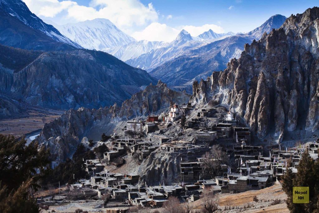
The Annapurna Circuit Trek is also one of the most trekked routes in Nepal. By now you should have realized the importance of the Annapurna Region and the wide variety of trekking trail this region hosts. Unlike other previous treks, the Annapurna Circuit Trek is a circuit of the Annapurna range of mountains. Trekkers get to exerience varying range of terrain, culture and experiences packed all into one trekking route.
The highest and the most difficult point to get to is the Thorung La Pass at 5,416 meters. It provides a breathtaking panoramic view of the mountain ranges. Moreover, the high altitude lake Tilicho is also one of the highlights of this trekking in the Annapurna Circuit.
Usually starting counterclockwise from Besi Sahar or Bhulebhule, the circuit goes behind the Annapurna range finishing at Jomsom or Nayapul. Trekkers also pass by the village of Muktinath and Kaagbeni – famous areas for Hindu and Buddhist pilgrimages with ancient temples.
Altitude and AMS at the Annapurna Circuit Trek
The Annapurna Circuit gets its fair share of points for putting trekkers down because of altitude sickness. As you might have guessed, it is very common for trekkers who rush the trek and do not acclimate properly.
Insider Tips for Annapurna Circuit Trek
Following are a few insider tips that our team at Nepal101 recommends for the Annapurna Circuit trek –
- We recommend starting the trek counterclockwise (starting from Besi Sahar) since the elevation gain is gradual and offers plenty of time to acclimate
- After Muktinath, the road for vehicles and trekking trails are different, where the trekking trail offers spectacular views. Make sure you choose the trekking trail and not walk on the busy/dusty vehicle road.
If you are looking to go on a longer trek exploring remote cultures and exotic villages – Annapurna Circuit Trek will not disappoint you.
Langtang Valley Trek
Quick Overview of the Langtang Valley Trek
Difficulty: Moderate
Best Months to Trek: Mar, Apr, May, Sep, Oct, Nov
Max Altitude: 4,773 meters or 5,033 meters
Program Duration: 10 Days
Annual Visitors: 15,000+

The Langtang Valley trek is hands down the best trekking route in terms of time, value for money and the up close-jaw dropping mountain views trekkers get to experience. Unlike the treks in the Annapurna region, the Langtang Valley trek is less crowded with travelers so it feels more pristine, untouched, secluded from commercialization and the only stone you will see will mainly be of the Buddhist Mani Stone Walls compared to the stone steps in the Annapurna Region.
The trek starts from Syabru Besi where the hills are covered with flora and lush greenery. The trail initially passes through fascinating Tamang villages, river powered prayer wheels and natural springs. As the elevation picks up, you get the first glimpse of the Langtang Ri which will make you hungry for more of the snow capped mountain view. The trail’s landscape gets drier and rockier with increased elevation, with horses and Yaks accompanying you in the trail.
You can get a sense of real himalayan lifestyle once you reach the Langtang Valley. Langtang was also one of the drastically affected region during the 2015 earthquake. Make sure you walk on the left side of the symbolic Buddhist Mani Stones (Prayer Walls) while heading to Kyanjin Gomba (3870 m.), the final resting point for the Langtang Trek.
The highlight of the trek is when you are on top of the Kyanjin Ri (4,773 meters) or Tserko Ri (5,033 meters). You can see panoramic views of the Ganesh and Langtang mountain ranges at these viewpoints. Moreover, if you pay close attention, you might be able to see tumbling glaciers far away in the mountain ranges. This breathtaking trek is truly rewarding, it will put a big smile on your face and leave you feeling very accomplished.
Langtang Valley Trek Distance Coverage
Altitude and AMS at Langtang Valley Trek
From Syabru Besi to around Lama Hotel or Ghoda Tabela is under the 3000 meters mark. Thus, the chances of getting altitude sickness is not high until Lama Hotel. However the altitude gain to Langtang Valley is very steep and quick. This increases the chances of getting sick. Our customers usually start getting light symptoms after reaching Langtang Valley. However, after a good night of rest and warm food, the symptoms usually disappear.
Insider Tips for Lantang Valley Trek
Following are a few insider tips that our team at Nepal101 recommends for the Langtang Valley Trek –
- Make sure to try the special Yak Cheese in Kyanjin Gomba, it is worth the small hike up the village. The shop is government operated and the prices are transparent. (Update – after the earthquake they are rebuilding this cheese factory)
- There are following places you can summit keeping Kyanjin Gomba as the base. Lower Kyanjin Ri, Upper Kyanjin Ri known as the Daniel Kafle Peak or Tserko Ri. Make sure you wake up early and witness the majestic sunrise.
- A bowl of hot Oatmeal is a great way to get the carbs needed for the acclimatization and peak climbing days.
If you are looking for an exotic trek with less number of trekkers and more culturally inclined towards the Tamang people covering wet and dry terrains – Langtang Valley Trek is a great option.
Langtang Valley Trek Map

Mardi Himal Trek
Quick Overview of the Mardi Himal Trek
Difficulty: Moderate
Best Months to Trek: Mar, Apr, May, Sep, Oct, Nov
Max Altitude: 4,500 meters
Program Duration: 10 Days
Annual Visitors: 25,000+
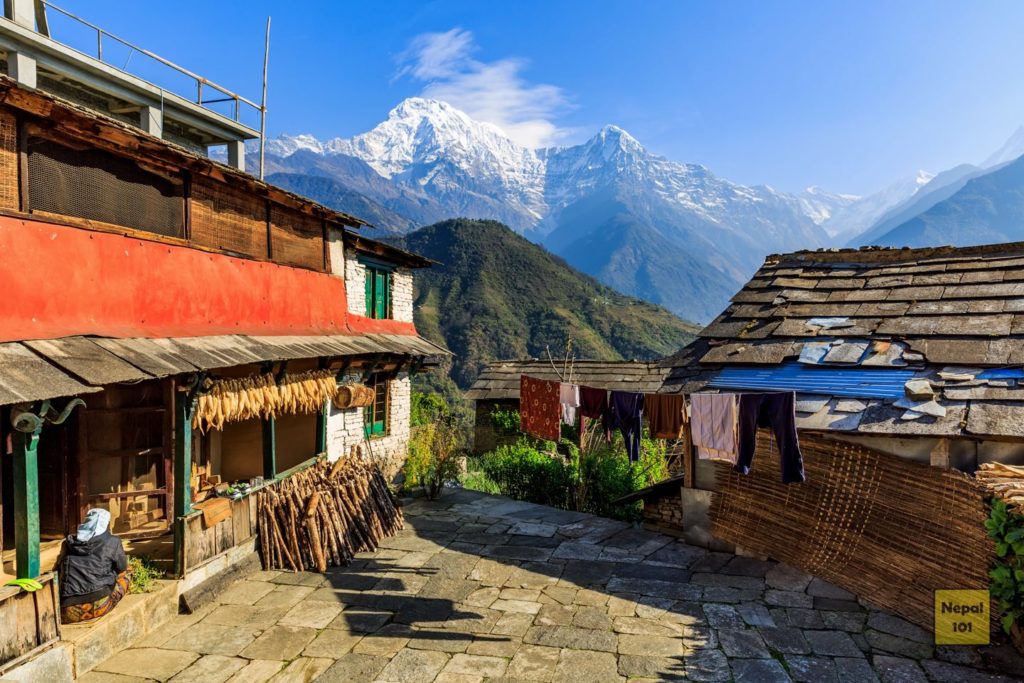
Mardi Himal Trek is one of the newly popular trekking route in the Nepal and takes place in the Annapurna Region.
If you want to travel the trek which has fewer people, want to experience tranquility, enjoy beautiful scenery, and witness the special Fish-Tail Machhapuchre Mountain up-close, then Mardi Himal Trek is exactly what you are looking for. It is a relatively easy trek and ideal for first-time trekkers in terms of difficulty.
Mardi Himal Trek Distance Coverage
Altitude and AMS at Mardi Himal Trek
The Mardi Himal Trek passes through some jungle areas in the beginning. As trekkers pass through the dense rhododendron forests the altitude is fairly lower than 2,500 meters. After the forest area, there is an uphill trek that takes the trek’s elevation to 3,300 meter. The landscape changes veru quickly into a rugged high mountain landscape where the mountains are ready to welcome you.
We recommend you to practice extreme caution starting Low Camp since there is a sudden increase in altitude here onwards.
Insider Tips for Mardi Himal Trek
Following are a few insider tips that our team at Nepal101 recommends for the Mardi Himal Trek –
- Mardi Himal Trek has the least number of tea-houses around the Annapurna Conversation Area. Make sure you have a tea-house secured before you head to the treks.
- Mardi Himal Base Camp provides stunning view of the Fishtail Mountain. The path from High Camp to the Base Camp is very beautiful.
- Make sure to pack chocolates, dry fruits or carbs for your hike to the Mardi Himal Base Camp.
The Mardi Himal Trek is gaining a lot of interest and popularity in the recent years and is a relatively new trek. It is less crowded but also has minimal housing facilities. Therefore, make sure you are well prepared before your trek to the Mardi Himal Base Camp.
Mardi Himal Trek Map

Everest Base Camp
Quick Overview of the Everest Base Camp
Difficulty: Moderate – Hard
Best Months to Trek: Mar, Apr, May, Sep, Oct, Nov
Max Altitude: 5,545 meters
Program Duration: 15 Days
Annual Visitors: 25,000+
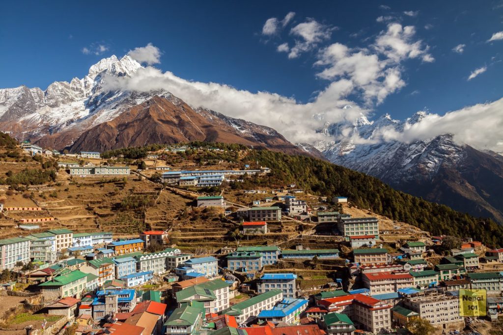
The Everest Base Camp Trek is undoubtedly the adventure of a lifetime. It is the most beautiful and breathtaking trek in Nepal. The trail will follow the same route walked by the Mt. Everest expeditions teams. The trek will take you over breathtaking suspension bridges, mysterious Buddhist monasteries, and into the heart of the hard working and exceptional Sherpa people. All towered over by some of highest and most stunningly beautiful mountains of the world. Besides Mount Everest, some other prominent peaks visible during the trek include Lhotse (8,501 m), Makalu (8,463 m), Cho Oyu (8,153 m), and Ama Dablam (6,856 m).
You will experience the landing at the world’s most dangerous airport – Tenzing-Hillary Airport. The trek starts from Lukla which goes through Pkhading, Namche, Tengboche, Dingboche, Lobuche, Gorak Shep, EBC, Kala Patthar and back through Namche.
Everest Base Camp Trek Distance Coverage
Altitude and AMS at the Everest Base Camp Trek
The secret to completing the Everest Base Camp Trek is having scheduled acclimation days at a few pivotal points of the trek. The first acclimatization need to be planned at Namche. The statistics of trekkers getting sick after not having an acclimatization vs having an acclimatization day in Namche is significant. We add another one at Dingboche, just a few days before we push towards the base camp and Kala Patthar.
Insider Tips for Everest Base Camp Trek
Following are a few insider tips that our team at Nepal101 recommends for the Everest Base Camp Trek –
- Avoid meat items in the Everest Base Camp trek, since the meat has to be hauled all the way from Kathmandu. (There are No Slaughter Houses in the Khumbu region for religious reasons). Many trekkers get sick eating meat items. Canned fish items are okay.
- To avoid the big crowds, get early start each day, especially on the acclimatization days.
You can never go wrong with the Everest Base Camp Trek. It is not for the faint of heart – but it does leave with big feeling of accomplishment. You will undoubtedly be smiling from ear to ear once you have conquered the Everest Base Camp trail.
The Everest Base Camp Trek Map

The Everest Base Camp Trek starts after landing at the Lukla Airport from Kathmandu. You will pass through Phakding, Namche, Tengboche, Dingboche, Lobuche and Gorakshep before finally conquering the Everest Base Camp. The train back is the same as the way up.
Everest Base Camp + Gokyo Valley Trek
Quick Overview of the Everest Base Camp + Gokyo Valley Trek
Difficulty:Moderate – Hard
Best Months to Trek: Mar, Apr, May, Sep, Oct, Nov
Max Altitude: 5,545 meters
Program Duration: 19 Days
Annual Visitors: 25,000+
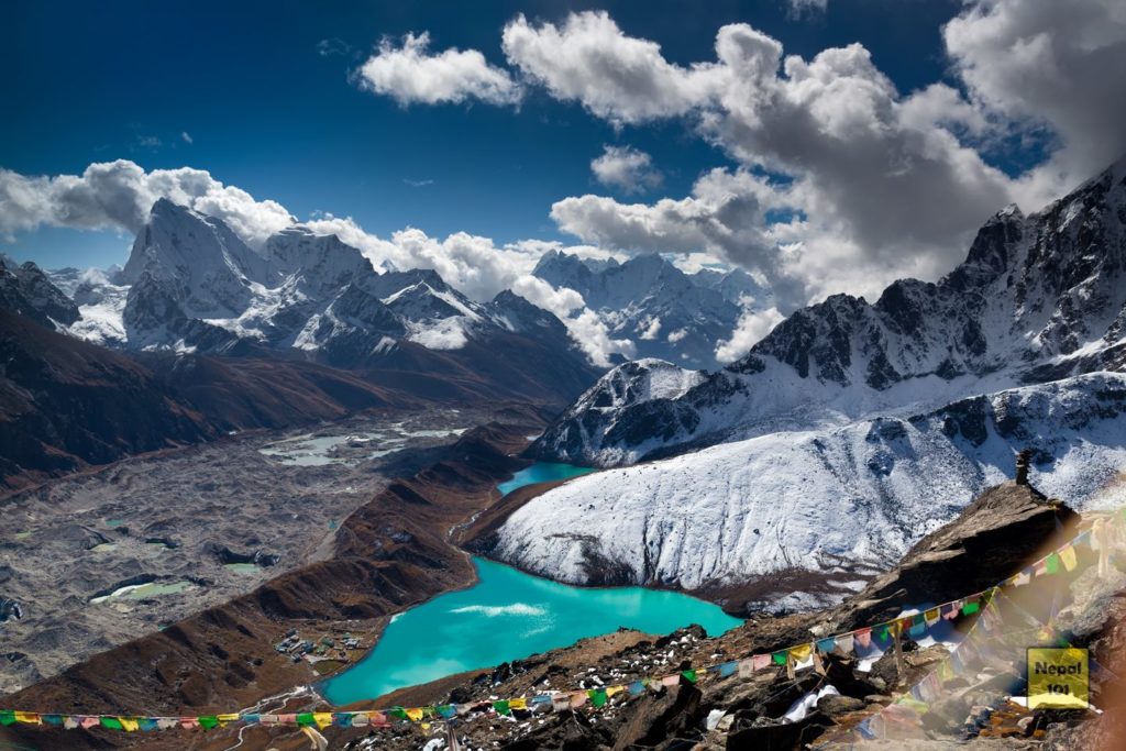
Everest Base Camp Trek with Gokyo Lake via Chola Pass is “the” ultimate adventure in the Himalayas. It is the most beautiful and breathtaking trek in Nepal. The trail will follow the same route that previous famous expeditions to Mt. Everest have walked through with an addition of Chola Pass and the turquoise lake village of Gokyo.
The trek to the Everest Base Camp at 5,364m to the base of the world’s tallest mountain will take you over breathtaking suspension bridges, mysterious Buddhist monasteries, and into the heart of the hard working and exceptional Sherpa people, all towered over by some of highest and most stunningly beautiful mountains of the world. After conquering the Everest Base Camp, this treks summits over Chola Pass and guides you to the sacred turquoise Gokyo Lake.
Besides Mount Everest, some other prominent peaks visible during the trek include Lhotse (8501 m), Makalu (8463 m), Cho Oyu (8153 m), and Ama Dablam (6856 m).
Everest Base Camp + Gokyo Valley Trek Distance Coverage
| Trekking Trail Route | Distance (km) | Time (hrs) | Altitude (m) | |
|---|---|---|---|---|
| 1 | Lukla to Phakding | 6.2 | 4 - 5 hrs | 2,620.00 |
| 2 | Phakding to Namche Bazar | 10.2 | 5 - 6 hrs | 3,440.00 |
| 3 | Namche to Sagarmatha Museum | 1.1 | 1 - 2 hrs | 3,550.00 |
| 4 | Namche to Everest View Hotel | 1.5 | 3 - 4 hrs | 3,962.00 |
| 5 | Namche to Tengboche | 9.2 | 5 - 6 hrs | 3,749.00 |
| 6 | Tengboche to Dingboche | 11.0 | 5 - 6 hrs | 4,440.00 |
| 7 | Dingboche to Lobuche | 12.0 | 5 - 6 hrs | 4,930.00 |
| 8 | Lobuche to Gorak Shep | 4.0 | 3 - 4 hrs | 5,170.00 |
| 9 | Gorak Shep to Everest Base Camp | 3.5 | 3 - 4 hrs | 5,346.00 |
| 10 | Gorak Shep to Kala Patthar | 2.0 | 3 - 4 hrs | 5,545.00 |
| 11 | Gorak Shep to Dzongla | 10.0 | 5 - 6 hrs | 4,830.00 |
| 12 | Dzongla to Thangnak | 11.5 | 8 - 10 hrs | 4,950.00 |
| 13 | Thangnak to Gokyo Village | 8.0 | 5 - 6 hrs | 4,950.00 |
| 14 | Gokyo Village to Gokyo Ri | 2.1 | 3 - 4 hrs | 5,357.00 |
| 15 | Gokyo Village to Dole | 9.5 | 6 - 7 hrs | 4,034.00 |
| 16 | Dole to Namche | 10.5 | 5 - 6 hrs | 3,440.00 |
| 17 | Namche Bazaar to Lukla | 17.7 | 6 - 7 hrs | 2,840.00 |
| Total 130.0 |
Altitude and AMS at the Everest Base Camp + Gokyo Valley Trek
The Everest Base Camp Trek+ Chola Pass Trek has multiple acclimation days – scheduled acclimation days at a few pivotal points of the trek. The first acclimatization takes place at Namche. The statistics of trekkers getting sick after not having an acclimatization vs having an acclimatization day in Namche is significant. We add another one at Dingboche, just a few days before we push towards the base camp and Kala Patthar. The final acclimation day is at Gokyo Village conquering the Gokyo Ri.
Insider Tips for Everest Base Camp + Gokyo Valley Trek
Following are a few insider tips that our team at Nepal101 recommends for the Everest Base Camp + Chola Pass Trek –
- Avoid meat items at all cost. Load up on Garlic Soup and drink a lot of water. The meat has to be hauled all the way from Kathmandu. (There are No Slaughter Houses in the Khumbu region for religious reasons). Many trekkers get sick eating meat items. Canned fish items are okay.
- Go slow and maintain the pace. Do not challenge yourself a lot – the goal of the trek is to finish, not finish first or quick. The chances of no getting sick depends on how much you exert your body, so take it slow and steady.
This trek is not for the faint of heart – but it does leave with big feeling of accomplishment. It is challenging yet overly satisfying. You will be amazed with your self and grinning ear to ear recalling memories of the Everest Base Camp + Chola Pass Trek.
The Everest Base Camp + Gokyo Valley Trek Map

The Everest Base Camp Trek + Gokyo Valley Trek starts after landing at the Lukla Airport from Kathmandu. You will pass through Phakding, Namche, Tengboche, Dingboche, Lobuche and Gorakshep before finally conquering the Everest Base Camp. After conquering Kala Patthar, you will head towards Dzongla and then go over Chola Pass through Thangnak before arriving Gokyo Village. After Conquering Gokyo Ri, the trek continues back to Namche.
So there you have it, a comprehensive list of the Best Treks in Nepal for you to choose and decide.
Which of the treks listed are you planning to go in your next adventure to Nepal? If you have any questions, please feel free to reach out and we will try our best to help you.
Check Private Treks


